Landscape & Urban Modeling
Design beyond the building, shape the environment.
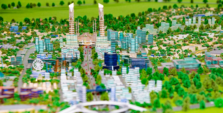
Our Landscape & Urban Modeling service supports the design and management of vibrant, resilient urban spaces by integrating natural elements, built environments, and spatial data into comprehensive 3D digital models. These models are not just visualizations, they are functional tools used across urban design, infrastructure planning, and sustainability analysis.
We deliver:
- Accurate topographic and terrain modeling using LiDAR, drone mapping, or geospatial data
- 3D representations of parks, open spaces, road networks, and urban furniture
- Environmental layers such as vegetation, drainage, sunlight, and slope for climate-sensitive planning
- Seamless integration with GIS systems for zoning, infrastructure, and utility layers
- Simulation-ready scenes to analyze pedestrian flow, mobility options, or noise and pollution impact
- Interactive visual outputs for public participation, stakeholder engagement, and regulatory submissions
- Outputs aligned with BIM and GIS ecosystems, ensuring long-term usability for asset management
From early design through city-wide digital twin initiatives, our landscape and urban models empower planners, architects, and public agencies to envision and build smarter, greener, and more livable cities.